10
Years in Business
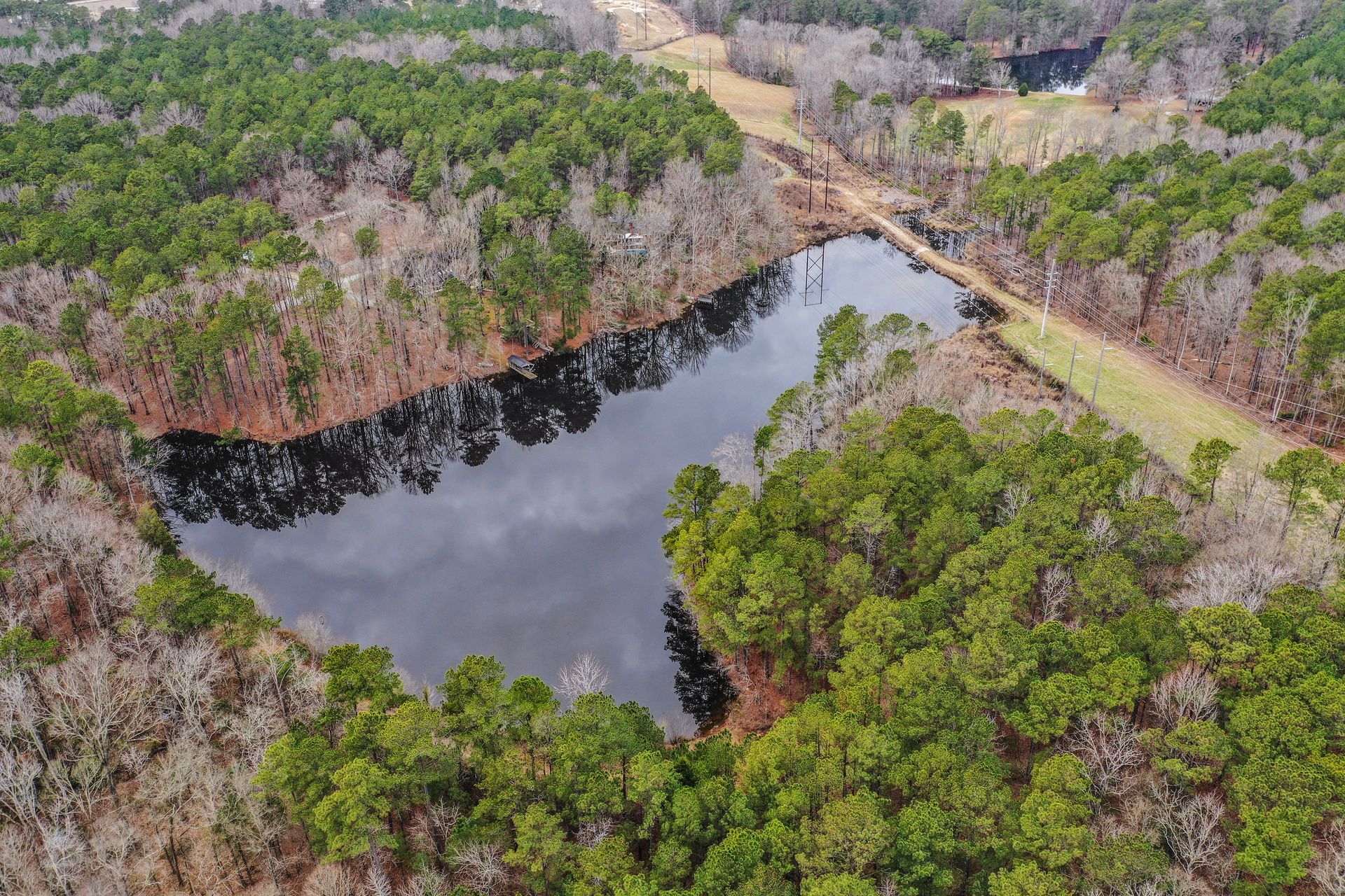
Maps That Show Your Site as It Exists
Orthomosaic and environmental mapping services for accurate site visuals and land assessment in Columbia, South Carolina.
When your project in Columbia requires a georeferenced map that shows every detail of your site at a specific point in time, orthomosaic mapping stitches together hundreds of aerial images into a single, scaled, and distortion-corrected visual. You see property boundaries, vegetation patterns, drainage paths, and existing structures in their true spatial relationships, making it easier to plan development, monitor environmental changes, or document conditions before and after site work. The map integrates directly into GIS software, so your team can measure distances, calculate areas, and overlay design plans without revisiting the site for additional measurements.
Back Forty Aerial Solutions generates orthomosaic maps from drone imagery captured during systematically planned flights over your property. The resulting map is accurate enough to support permitting, environmental monitoring, and land assessment tasks that once required extensive manual fieldwork. Environmental mapping services extend this capability by tracking vegetation health, erosion, wetland boundaries, and other features that change over time, giving you a reliable method for change detection and compliance reporting.
If your project in Columbia needs a georeferenced site map or ongoing environmental monitoring, reach out to discuss coverage areas and delivery timelines.
How Aerial Images Become Accurate Maps
Your mapping project begins with a flight over the site in Columbia, during which the drone captures overlapping images from a consistent altitude. Back Forty Aerial Solutions uses photogrammetry software to align and stitch these images into a continuous orthomosaic map that eliminates lens distortion and perspective errors. Ground control points may be placed on site before the flight to ensure the map aligns precisely with real-world coordinates, making it compatible with survey data and existing GIS layers.
After processing, you receive a high-resolution map file in GeoTIFF or other georeferenced formats that open directly in mapping and design software. The map shows the site as it appeared on the flight date, with enough detail to identify individual trees, vehicle paths, material stockpiles, and infrastructure features. You can measure distances, calculate volumes, and compare the current map to older versions to detect changes in vegetation, grading, or land use.
Environmental mapping services build on this foundation by scheduling repeat flights over time, allowing you to track erosion, monitor restoration efforts, or document seasonal vegetation shifts. The service reduces manual fieldwork requirements and provides a permanent visual record that supports regulatory compliance and long-term land management. Mapping does not include subsurface analysis or detailed elevation contours unless combined with LiDAR data, but it delivers accurate surface information that informs decision-making across a wide range of applications.
Understanding Map Accuracy and Practical Use
Orthomosaic mapping involves technical processing and spatial alignment, so it helps to understand what affects accuracy and how the maps fit into your existing workflows.
Back Forty Aerial Solutions operates all mapping flights in Columbia under FAA regulations and maintains current insurance for commercial operations. If your site requires an accurate orthomosaic map or ongoing environmental monitoring to support land management and compliance, contact us to review your project scope and coordinate flight scheduling.